
EL TORCAL NATURAL PARK AND NATURE RESERVE
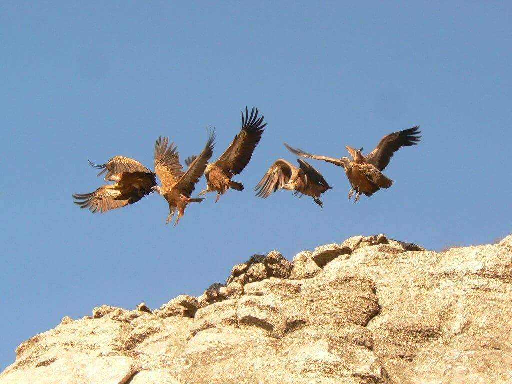
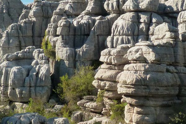
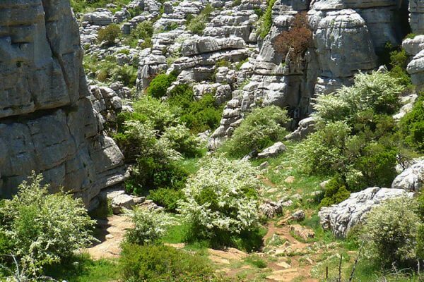
Firstly the boring bit. In the Jurassic period around 150 million years ago El Torcal was at the bottom of the ocean, the Earths crust was forced upwards when mountains were formed and the limestone setting of El Torcal was formed at some 1200 metres (4000 feet) above sea level. The wind and rain over the millennia has eroded the limestone to form the weird and wonderful shapes that cover some 20 sq km (12 sq miles).
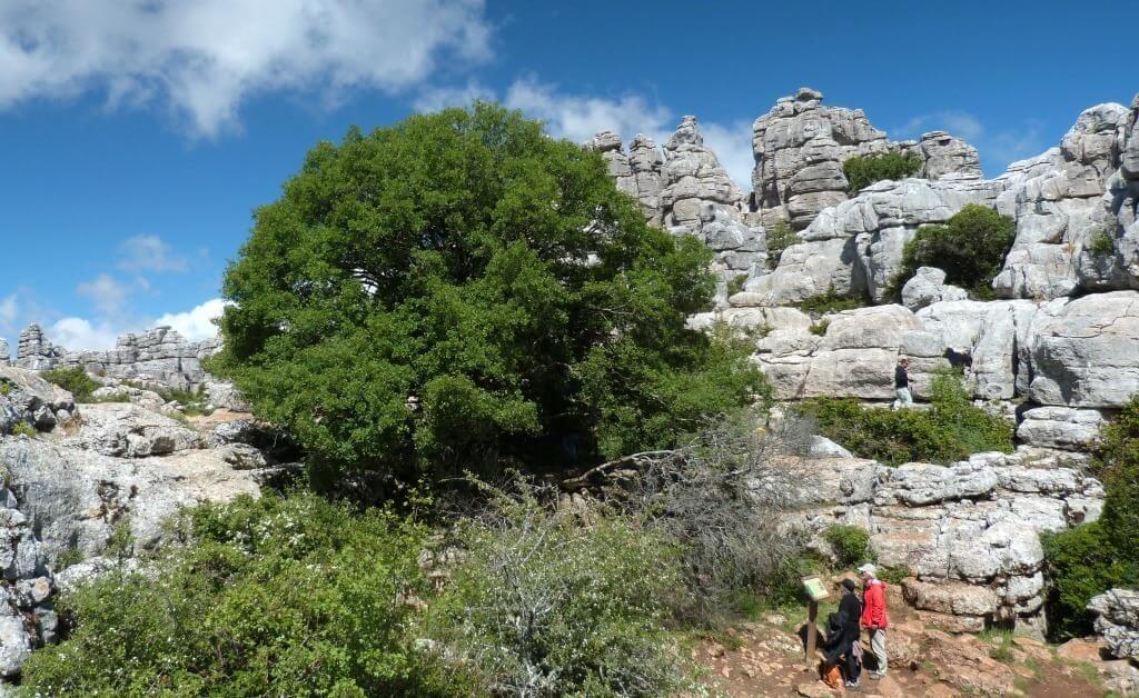
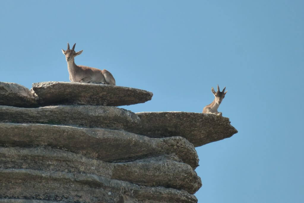
if you have no interest in how the formations came about you cannot help but be awed and amazed by the extraordinary landscape.
There are towers with layers stacked so high that they seem to defy gravity . Panoramic views that keep us coming back as they are always different, we have been here on fine sunny days when you can see forever, on one occasion we drove through the clouds and from the summit stood in brilliant sunshine looking down on the other mountain peaks jutting through a floor of white fluffy cloud.
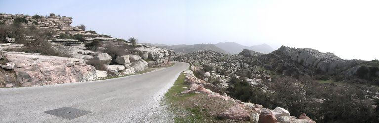
There are three walks through the park for the hardy and have been marked out with different coloured arrows on wooden sticks. The green route crosses the summit and is the shortest and easiest, 1,5 km.(about a mile) and takes about 30 – 40 minutes. The yellow route covers most of the green area, is 2,5 km. (just over a mile and a half) long and takes you to “Las Ventanillas” The Windows, at 1.200 m. for panoramic views of the valley of Málaga. Finally the red route is the longest and most difficult, 4,5 km.(close to three miles) taking about three hours, with a viewing point 1.340 m. up where you can see the whole of the El Torcal Park. Also a very short distance from the car park is a “mirador” or viewing platform with fantastic views and an orientation table, that points out Villanueva de la Concepcion, the region of Campanillas River and Málaga, and on a clear day the coast of Africa.
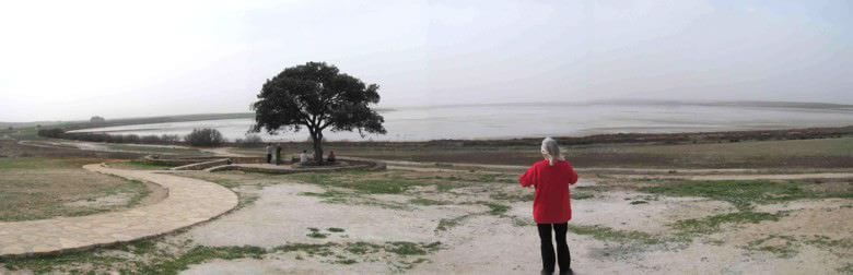
PARQUE ARDALES AND EL CHORRO
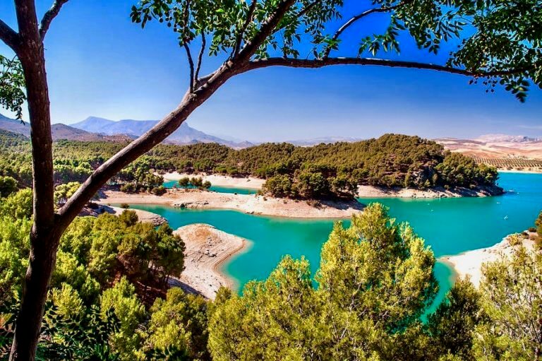
The town of Ardales is surrounded by beautiful countryside, particularly because of the three made made reservoirs that supply the province of Malaga
These are all massive the El Conde de Guadalhorce, El Guadalteba and El Guadalhorce. The Parque Ardales takes in El conde de Guadalhorce and scenery is constantly changing with the seasons, as the water rises and falls (it is around 40% full in the picture below)
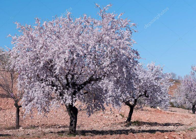
If you can make the trip in the springtime mid January – February and early March and are fortunate enough to catch the Almond trees that line the Ardales end of the shore in bloom you cant expect a breathtaking vista of the deep blue water and masses of the pink almond blossom making a frame that changes with every twist in winding road that follows the contours of the lake.
There are idyllic campsites, restaurants, bars, tapas kiosks, pleasant walks, you can rent a kyak, fish, swim, relax on a beach. In fact all of the recreation available on the crowded coast is here and relatively remote.
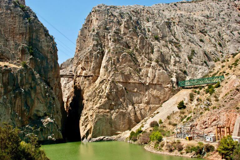
The Park also incorporates “El Chorro” where sheer rocks rise from the deep green water resembling the hide of an Elephant with deep grey wrinkles. A great favourite with rock climbers and another spot where if you look you are almost guaranteed to see an Eagle soaring around the peaks.
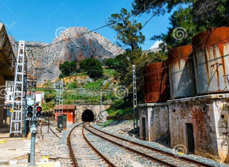
The Caminito del Rey began its construction in 1901 and took four years to complete soon becaming part of the life of the inhabitants of El Chorro and the surrounding villages.
King Alfonso XIII, opened the Conde del Gualdalhorce dam. Since then, this route has been known as the “Kings Walk” (el sendero del Caminito del Rey.
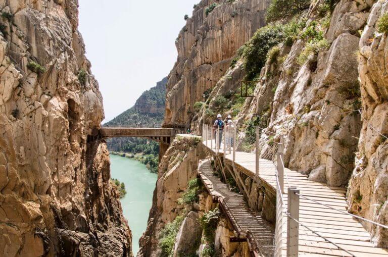
It was usual for people to walk route during the day and at night because it was lit. It was an important route of communication making the inhabitants of El Chorro able to take the children school. But over time nature took its course and left some sections impassable.
Although the adventurous and maybe foolhardy people continued to walk along its narrow footbridges. As a result there were several fatal accidents, and route was closed for several years.
In 2009, restoration work began to reopen the walk, and in 2015 it was opened again to the public. Now is one of the most famous landmarks in the country, you will be able to see one of the most spectacular landscapes of the Málaga mountain range, with steep walls towering to a great height above the Guadalhorce river which flows through this area after passing through the reservoirs of El Chorro, Guadalteba and Gaitanejo.
LA LAGUNA DE FUENTE DE PIEDRA
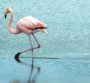
OK – I realise that if you don’t speak spanish that La laguna de fuente de piedra is a daunting title, but as long as you can find it on the map you will find that it has been been well worth your while remembering. Laguna de Fuente de Piedra consists of a large lagoon, with brackish water. The lake is 2.5 kilometres wide and 6.5 kilometres long, and has the biggest breeding colony of Flamingos to be found inland in Europe. The water is never more than four feet deep.
Although you are not allowed into the the lake itself, everything can be seen from outside the fence, there is a viewing area just in front of the reception building.
Make sure that you go into the reception building and shop, where off to the right is an excellent interactive exhibition with pictures and models supplying stacks of information about the flora and fauna of the reserve. There is also a small cinema that shows some really amazing photographs of the lake in all seasons and although the commentary is in spanish you really do not have to understand as the brilliant pictures speak for themselves.
On the way to the reception area is a small lake with reed beds where Terns can be seen as well as Reed Warblers and other species. Nevertheless, most of the fame of Fuente de Piedra is due to the Flamingos. It holds the largest colony of breeding Greater Flamingos.In Spain and, together with Camargue in France, is the most important breeding place for these birds in Europe. Up to 11,000 pairs breed here during the good years, though there have been years when not a single pair was able to breed because of the low water levels during dry periods. Other special breeding species also use the lake. In winter, the area is a good place to see wintering Cranes and Stone Curlews which can be found in the surrounding fields. During spring migration, it is an attractive site for Waders. In summer, it is advisable to visit early in the morning as the sun haze at noon makes identification of the the birds impossible. Temperatures can become very hot in this area. During dry years (1994-95, for example) the lake might be totally empty and when this happens birds are scarce. Historically the water was renowned for its curative powers, and gave the town its name. Those who drink it will be cured of their “mal de la piedra”, illness of the stone, meaning gall stones. After the Moorish domination, the town was abandoned in 1461, reconstructed once more in 1547. Then followed its period of maximum splendour, with the water being exported as far as the Kingdom of Naples and America. But after a series of epidemics in the 18th and early 19th centuries decimated the population of the town, and the fountain had to be lifted and brought to another site, and it was believed that this caused the water to lose its curative properties, and the fountain was abandoned, to be finally covered over in 1959. In 1994 it was restored and it can now be seen in the Plaza de la Constitución. The history of the town itself has always been closely linked with the history of the salt lake, the Laguna Salada. This was worked for the extraction of salt from Roman times until 1951. The lake was named a National Hunting Refuge in 1981.